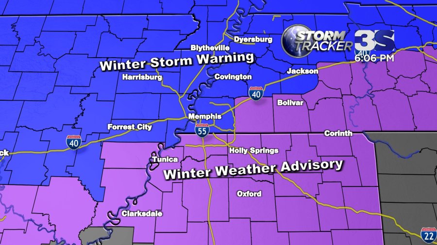
A winter storm with accumulating snow will be moving into the Mid-South late Tuesday afternoon into Tuesday evening. Areas along and north of I-40 are under a winter storm warning, whereas areas further south (where less snow is expected) have a winter weather advisory.

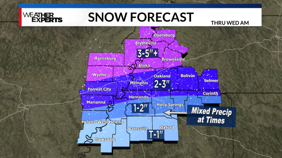
This will be a mixed bag of sleet/freezing rain/snow in many areas at the start, but we should all transition to snow overnight Tuesday. The storm ends by sunrise Wednesday morning, but with such cold air set to arrive there won’t be any melting for a few days.
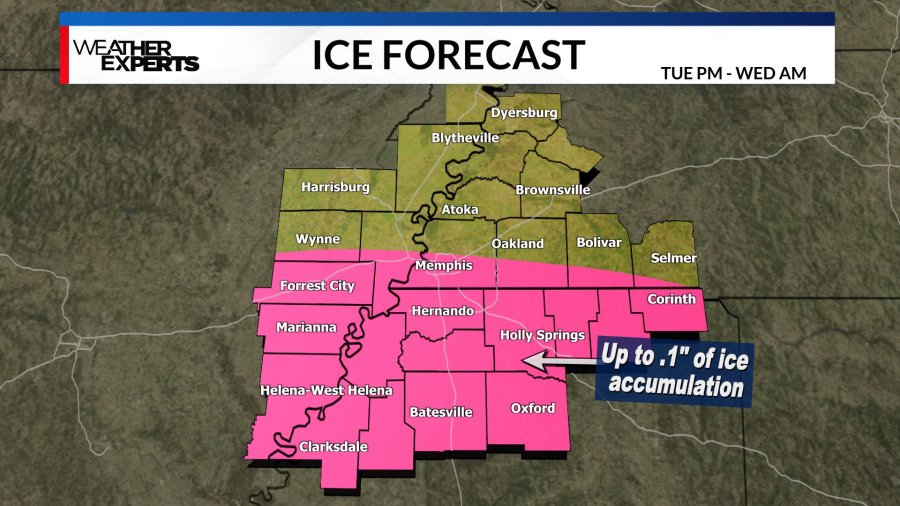
The highest snow totals will be further north closer to the bootheel of Missouri where some isolated may end up around 6″. The further south you go, the lower the snow totals will be. However, in the areas with lower snow totals some periods of freezing rain are possible Tue evening, which brings in a whole new set of issues. Ice accumulations will be patchy and fairly light, but any ice at all is problematic.
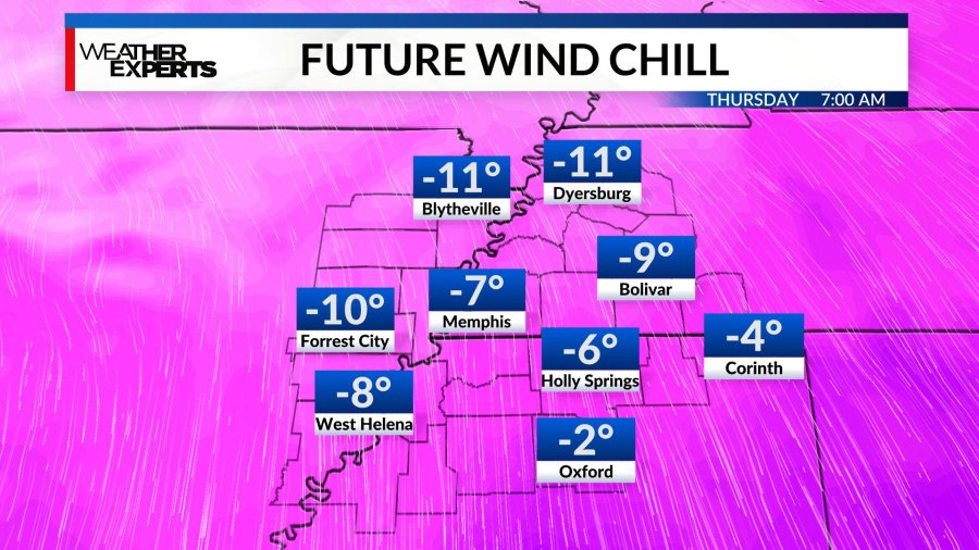
In the wake of our winter storm, dangerously cold air will be moving in. Highs will only be in the mid to high 20s on Wednesday and high teens/lows 20s Thursday – those numbers are about 35 degrees below normal! Expect dangerously cold night time lows in the single digits/low teens Wednesday night and Thursday night, with wind chill values below zero at times. You’ll need to take the proper precautions by planning to limit your time outdoors and dripping your faucets.
We don’t go back above freezing until at least Friday afternoon.
