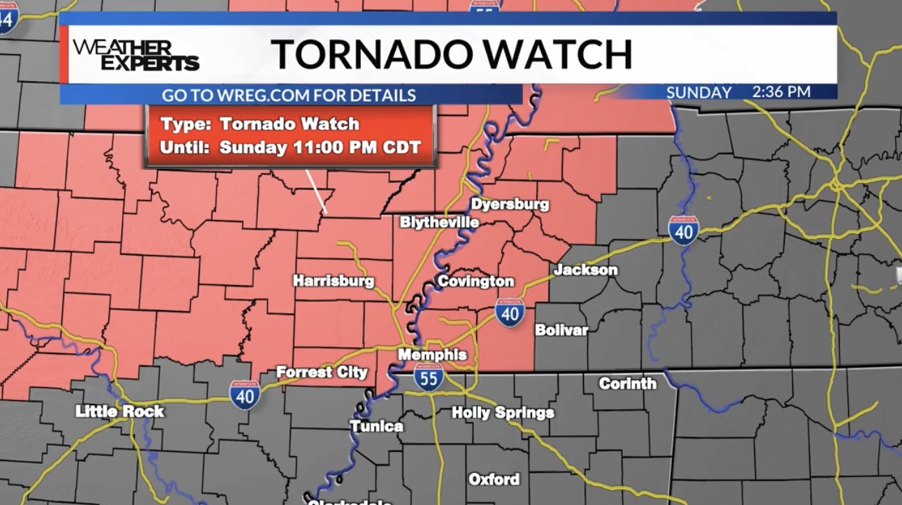
A TORNADO WATCH is in effect until 11pm.
Isolated supercell thunderstorms are expected to develop in the late afternoon/early evening in northeast Arkansas and the Missouri Bootheel. Later on, storms will congeal into more of a line as a cold front tracks eastward into the heart of the Mid-South.
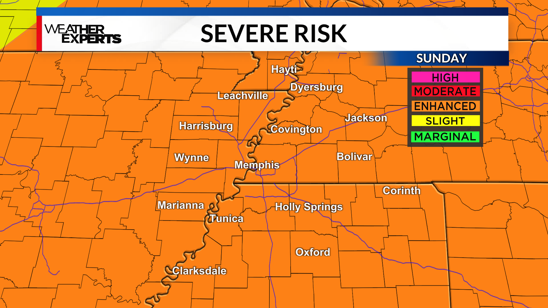
While all storms will not be severe, a few may reach severe limits with a threat for damaging winds, large hail, and isolated tornadoes. All of the Mid-South is under an “Enhanced Risk” (Level 3/5) for severe weather.
STAY CONNECTED – We encourage you to have multiple ways to receive weather information – especially as we head into April, which is another busy month for severe weather in the Mid-South. Download the WREG weather app for the latest forecast details while you are out and about this weekend. Make sure your location is turned ON, so you can receive watch and warning information for your exact location. With this potentially being an overnight event, you need a way to be woken up if a warning is issued. Keep your phone volume on loud. A NOAA weather radio is a great investment as well.
Should any warnings be issued in the Mid-South, our live coverage can be watched right here on digital-stage.wreg.com, as well as the new WREG+ app on your smart TV.
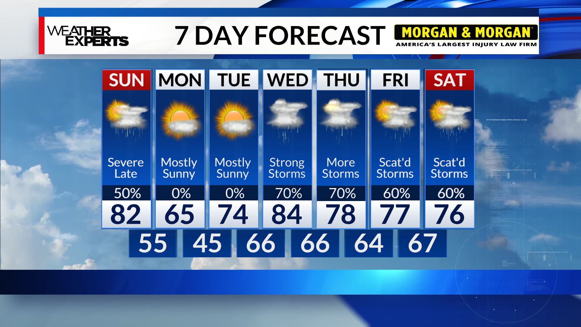
We’ll get a break from the rain and storms on Monday and Tuesday before our weather pattern turns active once again.
Several days of rain and thunderstorms will be likely Wednesday, all the way through next weekend. This will lead to 4-7″ of rainfall across the Mid-South, with locally higher amounts possible. Flooding will likely be a concern by the end of next week.