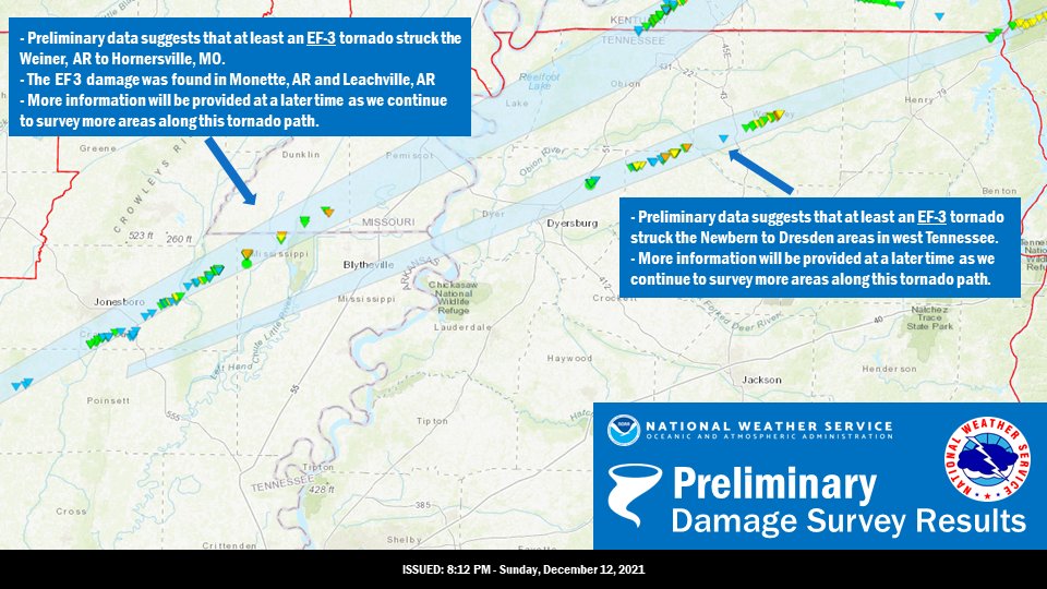
MEMPHIS, Tenn. — The National Weather Service continues to investigate the storms that ripped through parts of multiple states.

The NWS said in a tweet, “Preliminary findings suggest that at least two EF-3 tornadoes struck the Mid South Friday evening. We will continue to survey the damage along the paths of these two long track tornadoes. Rating is subject to change as we acquire more data.”
In addition, the Tennessee Emergency Management Agency provided more NWS data regarding storms in Tennessee.
According to a TEMA report, six tornadoes touched down in Tennessee:
- Perry County to Bucksnort in Hickman County, EF-1, 100 mph winds, 250 yards wide, 12.2 miles long
- Hickman County at I-40, EF-0, 85 mph winds, 100 yards wide, 4.66 miles long
- Dickson County, EF-2, 135 mph winds, 500 yards wide, 8.34 miles long
- Dickson County in Burns, EF-1, 110 mph winds, 175 yards wide, 5.3 miles long
- Cheatham County in Kingston Springs, EF-2, 125 mph winds, 400 yards wide, 10.5 miles long
- Davidson County at Percy Priest Lake to Mt. Juliet in Wilson County, EF-1, 105 mph winds, 100 yards wide 7.6 miles long
The National Weather Service updated the list of storms, adding four more to the list:
- Stewart County, EF-2, 125 mph winds, 400 yards wide, 22 miles long
- Smith County (South Carthage), EF-0, 80 mph winds, 75 yards wide, 6.9 miles long
- Clay County, EF-1, 105 mph winds, 75 yards wide, 5.8 miles long
- Hendersonville, EF-1, 95 mph winds, 150 yards wide, 6.2 miles long.
NWS Note: Stewart County tornado will most likely be a continuation of a tornado from west Tennessee that moved through the NW corner of Stewart County, TN and into Southern Kentucky.
This tornado crossed the Tennessee River west of Land Between the Lakes and did massive tree damage to heavily wooded areas uprooting thousands of trees along its path.


