Watch the latest forecast in the video player above.
**
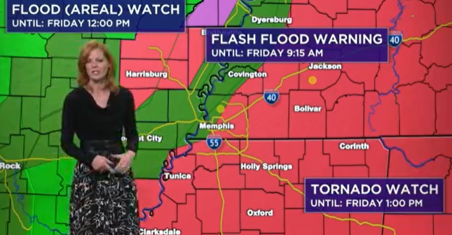
MEMPHIS, Tenn. — Several counties across the Mid-South are under a flood and/or tornado watch Friday.
As of 7 a.m., some counties in the News Channel 3 viewing area are under a Flood (Areal) Watch until 12 p.m., a Flash Flood Warning until 9:15 a.m., and a Tornado Watch until 8 a.m. and 1 p.m.
The following counties are under tornado watch until 8 a.m.: Shelby, DeSoto and Crittenden counties.
The following counties are under tornado watch until 1 p.m.: Madison, Lee, Gibson, Dyer, Obion, Henderson, Weakley, Lafayette, Hardin, Alcorn, Monroe, Fayette, Carroll, Haywood, Henry, Prentiss, Hardeman, McNairy, Marshall, Pontotoc, Union, Tippah, Benton, Chickasaw, Chester, Crockett, Tishomingo, Calhoun, Yalobusha, Itawamba, Decatur, Benton.
The rain should start clearing around noon Friday and should be gone by 5 p.m. Much of the area is under a Flood Watch and Wind Advisory.
McNairy, Fayette, Haywood and Hardeman County Schools announced they would be closed Friday because of the inclement weather.
Below is the Friday forecast from WREG’s Weather Experts:
Showers and thundershowers and the threat of severe weather this morning will transition into gusting winds and cooler temperatures today. We will see temps fall into the the 50s this afternoon and then near 40 overnight.
Sunny, breezy and cooler for the weekend. Severe weather threat this morning, but then improving this afternoon. Wind advisory and wind warnings in effect for this afternoon. Temps falling and a sunny and dry weekend ahead with highs near 60 Saturday and mid 60s by Sunday.