MEMPHIS, Tenn. — Wednesday will be our last day of 80s in the outlook. We have one more warm day today with clouds increasing ahead of a nice “Fall front.”
By Saturday and Sunday, high temperatures will only reach the 60s, and lows will dip into the 40s.
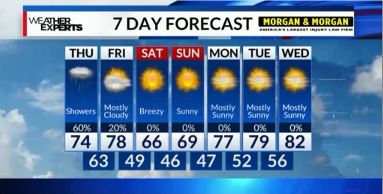
Wednesday, most of the News Channel 3 viewing area will remain dry but a shower or two is likely west of the Mississippi River. Highs will be in the 80s.
The cold front will be just to our west as begin the day on Thursday. It’ll be somewhat slow-moving, so they’ll be the chance for scattered showers essentially all day Thursday into Thursday night. The clouds and showers will keep temperatures in the low to mid 70s Thursday afternoon. We need the rain and the showers and general thunderstorms will be a welcome relief.
There will be a few leftover showers Friday morning before we start clearing things out during the afternoon. The cold front actually pushes through on Friday and then, much cooler and drier air will follow.
High temperatures will be almost 25 degrees cooler this weekend with mostly sunny skies. Highs will struggle to reach 70 on Saturday and Sunday, with lows in the 40s and 50s.
Welcome to an autumn weekend!