MEMPHIS, Tenn. — Be prepared. A significant winter storm will affect the News Channel 3 viewing area starting Saturday evening.
Update, 5:40 a.m. Sunday from the Weather Experts at WREG:
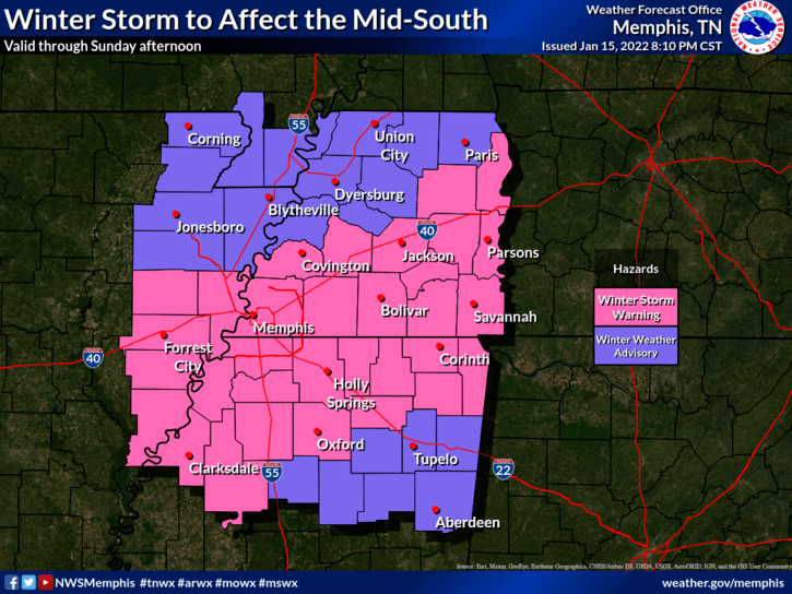
A WINTER STORM WARNING/WINTER WEATHER ADVISORY is in effect for the entire News Channel 3 viewing area through 3 p.m. Sunday afternoon.
The wintry precipitation is expected to be an all snow event during the early Sunday morning hours before Daybreak. Snow should end across most the area by noon with the highest anticipated accumulations snow totals in the 1-3″ range with 2-4″ possible. Forrest City already had an inch of snow reported at 2 AM and has several hours to go. Once again, this system is ever changing, so expected snow totals will change as well. The smart thing to do–stay tuned to News Channel 3 for continuing news and weather coverage of this anticipated storm.
Concerning wind as the winter storm system continues to churn east, expect breezy conditions. The combination of heavy wet snow and wind speeds up to 20-25 mph may cause tree and powerline damage. Please stay warm and be safe.
Update from the Weather Experts at WREG:
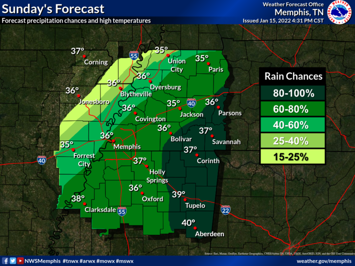
We have seen steady rain throughout the day with temperatures holding in the 40s since daybreak. IF all goes as weather models suggest, rain will eventually change over to snow this evening depending on your location.
The precipitation is expected to be an all snow event during the early Sunday morning hours before Daybreak. Snow should end across most the area by noon on Sunday with the highest anticipated accumulations amounts north of the Tennessee/Mississippi line.
Early estimates are for snow totals in the 1-3″ range with 2-4″ possible. There is even a chance of higher totals between Jackson and Nashville. Once again, this system is ever changing, so expected snow totals will change as well. The smart thing to do–stay tuned to News Channel 3 for continuing news and weather coverage of this anticipated storm.
UPDATE: The National Weather Service has issued a Winter Weather Watch for counties in West Tennessee, Eastern Arkansas and Northern Mississippi in effect from 9 PM Saturday until 3 PM Sunday.
The National Weather Service said heavy wet snow is expected and snow accumulation may reach two to four inches.


The event will start with rain — up to 1.5 inches of it. If you live in North Mississippi, the National Weather Service says to be on the lookout for potential flooding.
That will transition to snow beginning late in the evening and overnight into Sunday. NWS says it will be a wet, heavy snow. The most affected area will be West Tennessee, but North Mississippi should expect precipitation, too.
North winds of 15 to 20 mph could bring downed trees and power outages, NWS said. Travel will get dicey overnight with roads and bridges freezing. Snowfall will peak after midnight.
Yes, we’re getting snow. See how much
The WREG Weather Experts say 1-3 inches of snow is expected, although it could be more like 2-4 inches for some areas.
There is a Winter Storm Watch in effect for the entire News Channel 3 viewing area.


