UPDATE: Yes, we’re getting snow. See the latest models from Friday here.
MEMPHIS, Tenn. — The WREG Weather Experts are tracking an upper level low pressure system that is set to move into the Mid-South Saturday into Sunday.
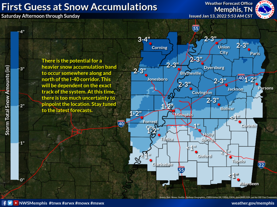
Cold rain will change to snow beginning across NE Arkansas and the Bootheel of MO Saturday and transition to snow across the rest of the News Channel 3 viewing area Saturday night into Sunday.
At this time, expect the entire Mid-South to see some snowflakes. The looming question is the timing, exact amounts, and the location of potentially heavier snowfall bands.
We could see no accumulation at all, or 1 to 2 inches, perhaps even more north of the city. As we’ve seen with our recent snow events, the line between accumulation/travel problems can be very small and ever changing. We will continue to track and keep you notified on the latest weather models as they arrive. Stay tuned!
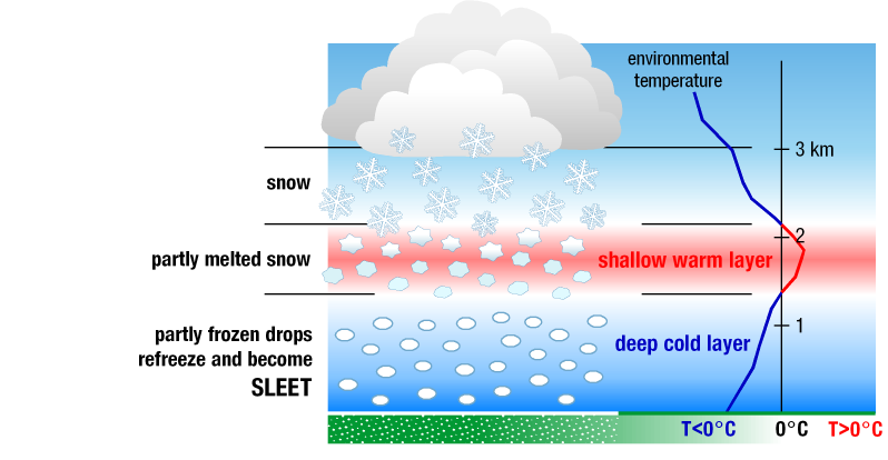
If the air at the surface is below freezing the flakes keep their pattern and accumulate on the ground as snow. This is what we are tracking this MLK holiday weekend.

A lot of science goes in to predicting if it will or will not snow.
One of the key factors to kick-starting the white stuff is “atmospheric lift,” which refers to anything that causes warm, moist air to rise from the ground into the sky for cloud formation. This occurs when two air masses collide and warm air rises over a colder “dome.” As water vapor rises, it eventually cool and falls back through the cloud as a liquid – or depending on the cloud’s temperature and humidity – ice crystals/snowflakes.


