See Wednesday night’s updated forecast
MEMPHIS, Tenn. — A winter storm, bringing significant amounts of snow to the Mid-South is on its way.
No major weather issues tonight, but it will be COLD. Lows will range from the teens to low 20s Thursday morning.
The first flakes will begin to fly Thursday evening and snowfall will intensify overnight.
Go ahead and plan on the majority, if not all, local schools being closed on Friday.
Snowfall amounts will vary across the Mid-South. See map below. Those north of I-40 can expect anywhere from 3-5 inches with 5-7 inches (with locally higher amounts) over the Memphis metro and those along and south of the I-40 corridor.
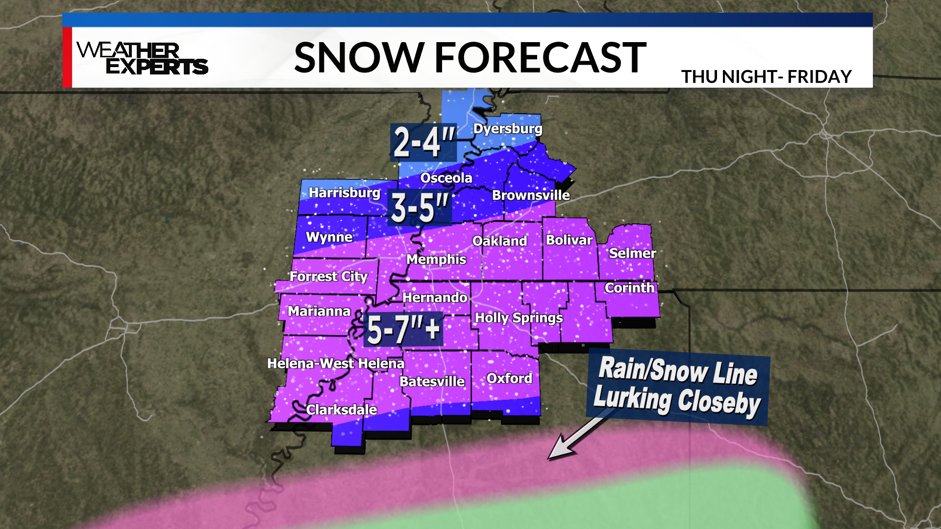
The biggest variable at this point is how much the rain/snow line gets involved in our far southern counties.
It’s going to be close, so expect some adjustments in those areas as the storm draws closer.
It’s important to remember though that the impacts, such as hazardous travel, will be similar everywhere regardless of how much snow you receive.
This will be a heavy, wet snow that could cause sporadic power outages.
Our team of weather experts has you covered every step of the way, and you should keep checking back with us frequently this week for updates.