NEW: See our Wednesday updates on snow forecasts
MEMPHIS, Tenn. — Welcome to winter! Some in our area saw some light snow flurries Tuesday morning.
It’s safe to say that everybody in the WREG viewing area is going to get at least a couple of inches of snow snow starting late Thursday night through the day on Friday.
Some of us will get significantly higher amounts of 6 inches or more.
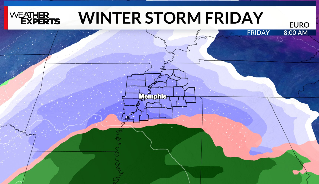
Where exactly those heavier bands will set up and how much snow to expect in your neighborhood are variables that will become more clear by midweek as the storm develops across south Texas.
All eyes are on our winter storm late in the week. As it stands right now, it’s not a question of “if” we’re going to have a storm, but rather how much snow we’re going to get in various locations, and whether a rain/snow line will come into play across far northern Mississippi.
Regardless, go ahead and plan on the majority of schools being closed on Friday. Chief Meteorologist Tyler Eliasen says it’s almost guaranteed that everyone in the Mid-South is getting a snow day.
A Winter Storm Watch for the entire viewing area for Thursday night through Friday night.
Temperatures all week long will remain well below normal with highs in the lower to mid-30s and lows in the lower to mid-20s.
Cold enough that you’ll want to drip your faucets at night to be safe.
Our team of weather experts has you covered every step of the way and you should check back with us frequently this week for updates. We’ll also have school closings on television and on digital-stage.wreg.com.