MEMPHIS, Tenn. — The winter storm is upon us. See the latest updates here.
Precipitation will begin to arrive around 10 p.m. from west to east Thursday night. It’s likely to start as a brief drizzle or sleet before quickly changing over to snow.
Just after 8 p.m., some viewers in Mississippi were already reporting sleet. Most of the area is likely to be engulfed by midnight or pre-dawn Friday, with sleet changing over to heavy, dense snow.
Snowfall will intensify overnight and remain heavy at times, especially from 4 a.m. to noon on Friday. It will gradually taper off from west to east Friday late afternoon and into the evening.
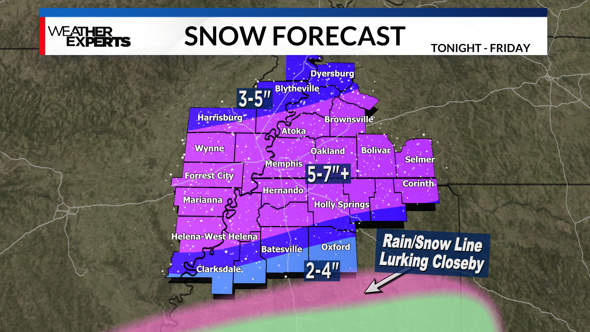
The majority of the WREG coverage area will receive at least 2-4 inches of snow. However, there will be a large swath of 5-7+ inches along the I-40 corridor. See graphic above for the latest forecast snow totals.
There is still an area of low confidence, especially in parts of Coahoma, Quitman, Panola, and Lafayette counties, where a brief changeover to rain and sleet may occur Friday morning. This would cut down on localized snow totals.
The snow is going to cause hazardous travel, so plan to stay at home on Friday. Even on Saturday, not much melting will occur as we will barely climb above freezing in the afternoon.
This will be heavy, wet snow that could also cause sporadic power outages.
Download the WREG Weather app, and watch for updates on air and online as this inconvenient and disruptive weather arrives in the Mid-South.